Favorite Local Hike: Temescal Canyon Trail, a Quick Guide

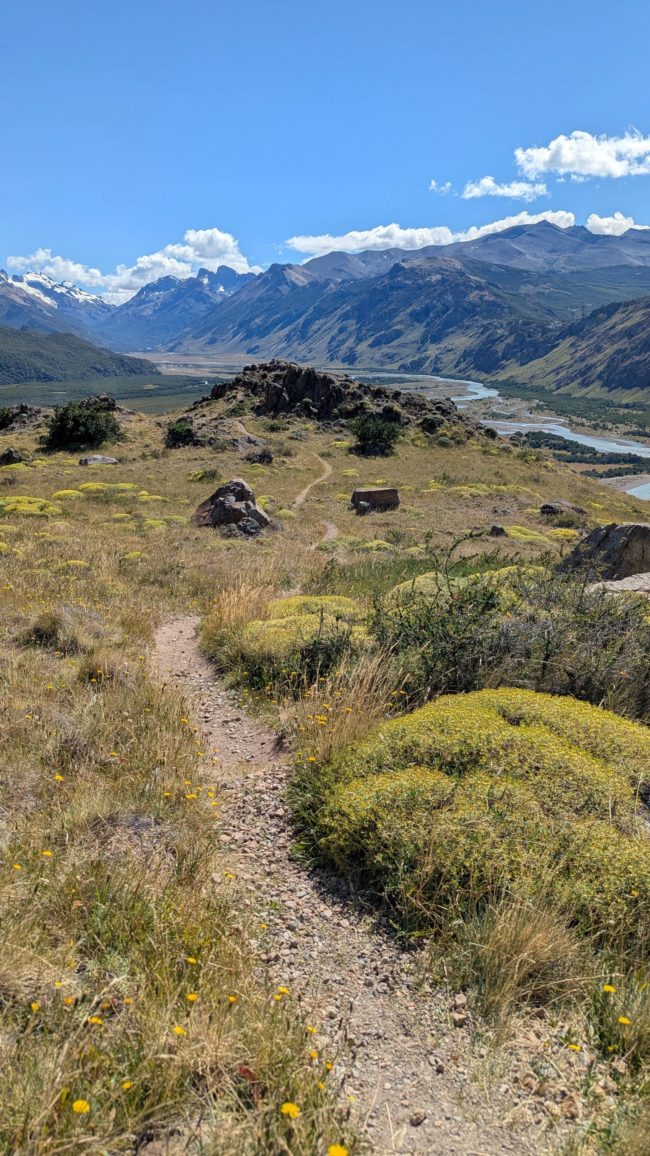
Best photo opp on Temescal Canyon Hike, I call this the Lookout as you can see multiple sides of the mountain and valleys
TRAIL CLOSURE
The JAN 2025 wildfires destroyed much of Pacific Palisades and this hike has been CLOSED ever since. :( I will update this note when I see the trail reopen… TBD.
If there is one city hike that captures the Westside and Los Angeles, it’s always and forever, the Temescal Canyon Hike. When we live in Westwood, we hiked the Temescal Loop weekly, often inviting friends, families and visitors. For our most recent wedding anniversary, we played hooky and hiked old, familiar loop! That’s how iconic this place is - it’s our go-to date spot. We even had our engagement photos taken on the grounds of Temescal Canyon Park — so it truly has a special place in our hearts.
Hence, I want to share my great love of this hike with others by sharing a few tips and learnings.

Why is Temescal Canyon my favorite, iconic LA hike?
3.8 mile loop trail, so no backtrack, great views of the ocean, epic photo Ops, great for active out of town visitors. Not too long (~2.2 hour hike), not too short. You don’t have to pack lunch.
Did someone say OCEAN VIEWS? It’s technically in Pacific Palisades, a stone’s throw from Santa Monica - and off of Sunset Blvd. The elevation gain means it tends to have an ocean breeze at the highest elevant -but be warned, on hot days, it’s hot!
Great workout - over 900 foot elevation gain, so you will break a sweat
Easy walking distance to Downtown Pacific Palisades - easy access to food, restaurants, and on Sunday mornings their Farmer’s Market, if you want to make a half day activity
Varied landscape - For LA hikes, it’s pretty few varied landscapes and plants as it starts in the valley (dry more shaded side) then goes up on the side of the mountain, so you are then walking on the side closest to the ocean (which has a marine layer). In summary, the microclimates capture make the landscape pretty varied given its close proximity. Don’t get me wrong, it’s a dry landscape, but lots of trees and shade for an LA hike!
Close to the city - from West LA you can get there in 20-30 minutes depending on traffic. Be an early bird and you’ll definitely beat beach traffic. So you can do hike, grab breakfast ,and shower all before noon! It’s my favorite Westside hike :)

The Bridge and Creek. Hiking landmarks call this the waterfall, but due to the ongoing drought it’s more like a drip-drip-drip.
Should I take the Loop Trail Counterclockwise or Clockwise?
It depends on personal preference!
We prefer taking the steepest climb earlier on (clockwise), which follows canyon views. When the trail peaks, we finally see the ocean. Then on our walk back towards the lot (as we loop back), we like seeing the Ocean to our right as we descend and enjoying what small ocean breezes are blown our way.
I’ve heard many friends prefer a more laid back hike and do the opposite direction (counterclockwise) — taking the ocean side path first (so the ocean is to their left). The trail ascends more gradually so it feels less strenuous. Then they take the steepest part on the way down, which feels easier cardio-wise (careful for your knees and joints :) ).
For more details on how to navigate the trail clockwise vs counterclockwise, checkout AllTrails.

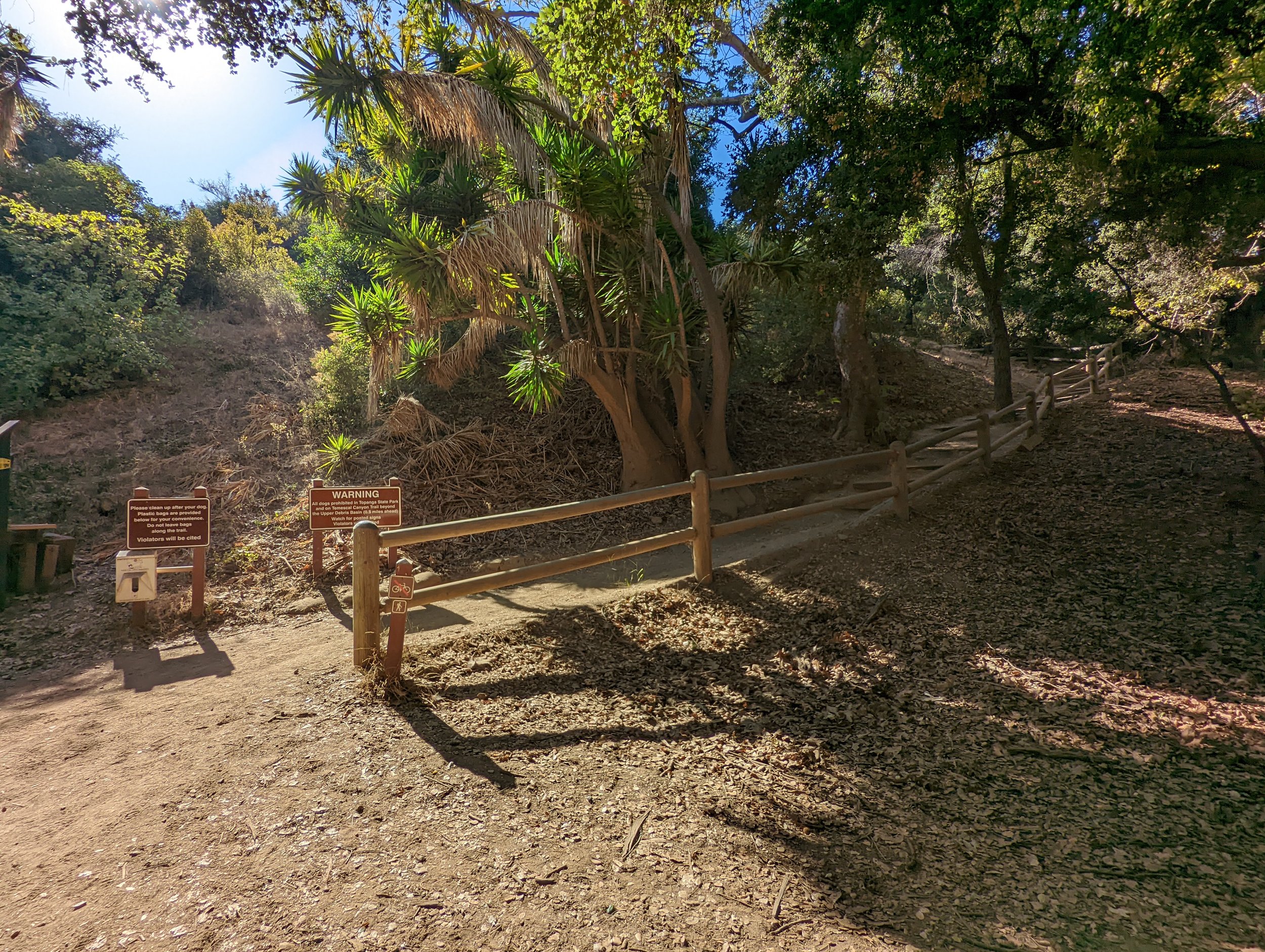
My go to start of Temescal Canyon Trail
What’s it like hiking Temescal Canyon?
Walk all the way through the park, past the recreation center and bathrooms. Note, there are at least two sets of bathrooms so if you are meeting at the bathrooms be clear if you are at the bathrooms closer to Sunset Blvd or the ones deeper in the park. I am referring to the back bathrooms, immediately next to the Recreation Center.
We like to start our hike at this pin drop, across from the Rec Center, near the Bathrooms and before the camp cabins. It is 20 feet near a cobble stone water fountain. Notice there are two trailhead signs reading Temescal Canyon Trail and Leacock Memorial Trail. Walk north. This trail leads you past the park cabins. If you prefer paved trails, you can skip this path and walk on the paved road to the back of the park. We like hiking in dirt, so always take the dirt path that parallels the paved road :)
The start and/or end of the loop trail (depending which direction you go)

Lots of low, arched trees providing dappled shade in the morning sun
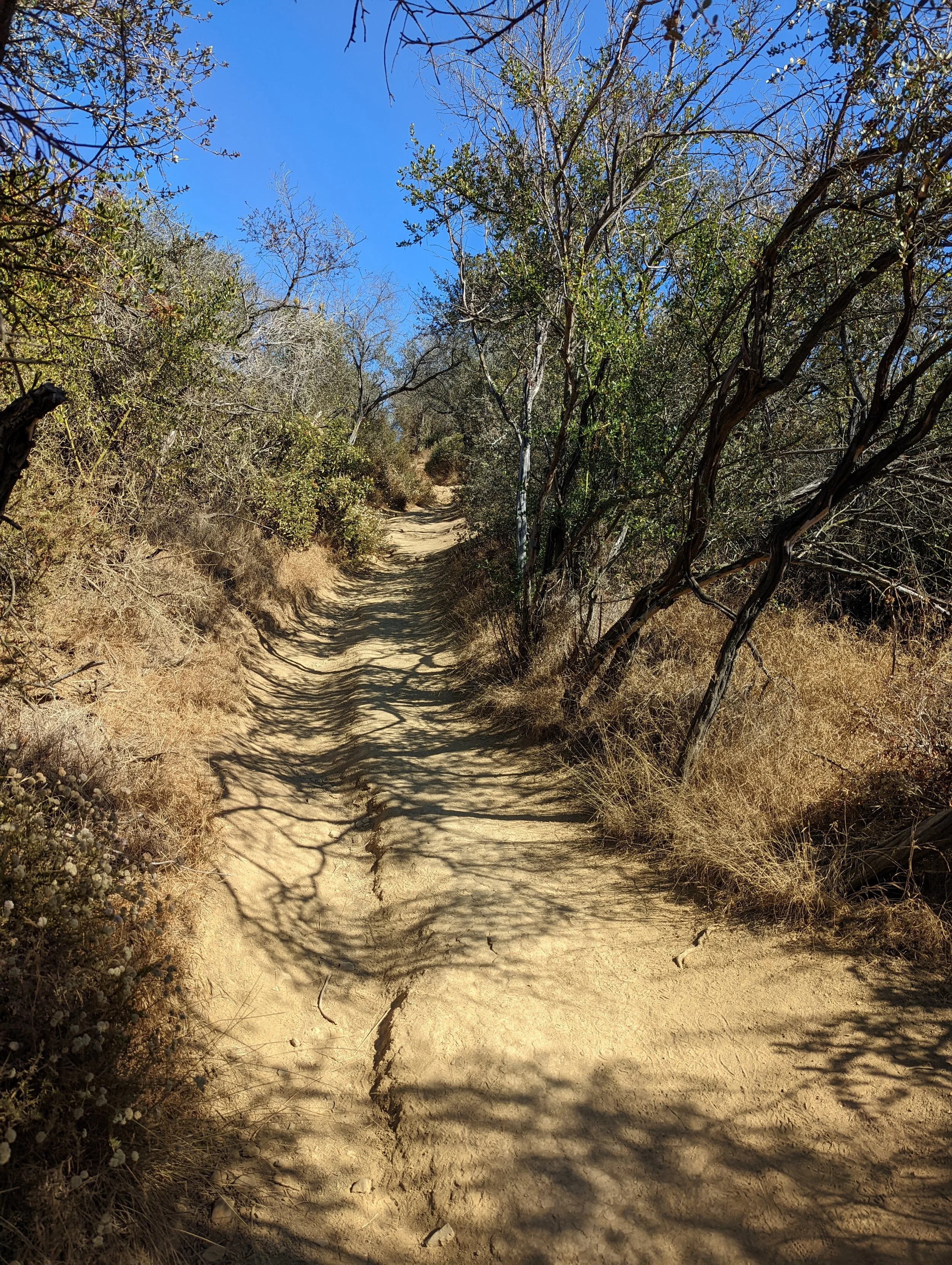
Most of the trail looks like this on the valley (non ocean) side

Rocks - sometimes it gets a bit rocky. Watch your step.

The Bridge: Best place to stop, have lunch, play in the creek (if there’s water), sit on boulders, and can hike back if you are done for the day :)

The Bridge aka The Waterfall (you won’t see a waterfall so stop looking!)

This is the “waterfall” - be ready to look for a small puddle
We keep walking and the path turns into a steep climb, some rocky, some dusty, and mostly in the sun - paralleling the valley with other mountains in the distance. Once you get to the Bridge (see above photo) or aka The Waterfall - you’re about 1/3 the way up the the mountain.
If you are looking for the waterfall, you’ve been deceived. It’s been a drought for what feels like a decade. Ain’t no water falling from these canyons. You’re lucky if you see a drip-drop of water trickling from the rock crevices! It’s actually the bridge. When you’ve reached the bridge - then you know that’s the creek / waterfall area. When there’s more water, I’ve seen kids playing in the creek, people sitting eating lunch, and just chatting. There’s a lot of dappled shade and boulders here. So if you want are feeling good, this is actually a good spot to hang out and then turn around and head back (if you’re maxed out).
If you’re like us, you continue up the mountain. The trail continues to get steeper!

This is us hiking up (elevation gain!)

The Hitching Post — you’re getting closer to the top!
When you see the Hitching Post (see above photo) - then you are 20 - 30 minutes from the top! Keep going!!
You will see a fork in the road. One will continue to Skull Road (I think it’s overrated so I only go if I want an extra hike) and the other goes to Temescal Canyon. The Temescal Canyon path goes upward and does a sharp turn, that’s the one you want to get to the epic ocean views!

Bienveneda Trail sign post - YOU’RE BASICALLY AT THE TOP!!! I do not take this trail (as it’s not a loop), but I rest, take photos, catch my breath before continuing on Temescal Canyon Loop.

Continue on this trail - the Temescal Canyon Trail - so you can get back to your car! Believe it or not, this is NOT the best view IMHO. Keep going :)

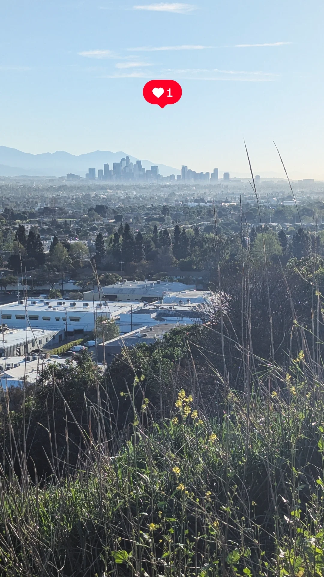
OK, now this is my favorite view on the Tesmescal Canyon Trail. 360s of the ocean and mountains, all sides of it! Incredible! Take all your IG selfies here plz.
Then on the way down, you experience a few rolling hills. It’s 90% all downhill! I say this as a caveat, as one time I announced it was ALL downhill and then my friend complained that my statement was inaccurate as there was a small hill LOL! Talk about a critic!
Parking
We are thrifty locals, hence we park on Sunset Blvd and Temescal Canyon Road (with a majority of spaces on Temescal Canyon Road). There’s always street parking (especially earlier in the morning, before 9:30a), it’s a matter of how far/long you are willing to walk to get to the trailhead. We don’t mind the walk (that’s the point of hiking lol!). If you are running late or want to cut to the chase, feel free to park in the official lot.
Official lot parking: Website says $12 parking, pay at the meter, follow posted signs and instructions. Park officials are infamous for ticketing so spare yourself and pay to park.
WARNING: Do not run the Park’s Stop Signs, come to a complete stop. I once did a rolling stop, and they mailed me a ticket later (darn cameras at select Park stop signs!). Save your money, be safe and come to a complete stop.
Park and walk to the trailhead at the very back of the park
Swing by the Pacific Palisades Sunday Farmer’s Market, around the corner (8a-1p)

Post-Hike @R&D Kitchen on Montana with well deserved drinks. Cheers!
I hope you found this post helpful! As always, say Hello and drop me a line, you’ll probably find me hiking or eating nearby (yum!): linhdy@outlook.com
Related Posts
How to Walk to the New La Cienega Pedestrian Bridge (walk to this from the Culver Stairs!)